#PUBLICATION Mapping of knowledge on Ciguatera and artisanal fishing
Posted by admin | March 29, 2021

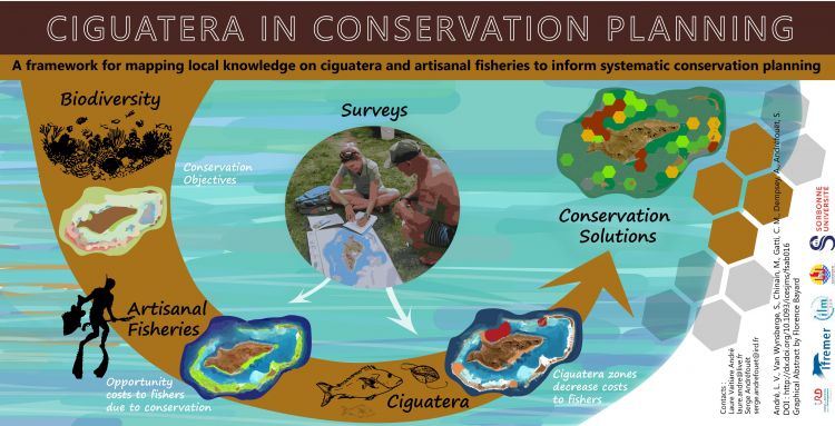
Millions of people depend on small-scale fishing. In many areas, however, fishermen are increasingly experiencing food poisoning due to ciguatera from eating contaminated seafood. The toxin, produced by a benthic dinoflagellate, can spread through marine food webs and affect humans through the consumption of fish or invertebrates. The risk of ciguatera can play a major role in lagoon fisheries, but it has never been considered in marine spatial planning. To address this gap, we examined whether incorporating ciguatera into systematic conservation planning would affect outcomes. We developed a seven-step methodology to collect and map local knowledge about hemlock and fishing activities via map-based interviews, including two innovations: (i) more accurately spatializing fishing areas by combining information on fishing gear and habitats and (ii) incorporating hemlock risk directly into the planning design, which is designed to maximize conservation of benthic habitats while minimizing impact to fishers. The approach is illustrated by the island of Raivavae, French Polynesia, in the Pacific Ocean. Our results show that incorporating ciguatera areas significantly improved the design of conservation plans, with a 24-38% decrease in costs to fishermen compared to scenarios based on fisheries data alone. This methodology is intended for use by scientists and managers to optimize the implementation of conservation plans, and could be generalized to all regions affected by ciguatera.
