Projet RESCUE
PROJECT SUMMARY
CONTEXT
Strandings of marine vertebrates (whales, dolphins, dugongs, turtles) are regularly observed on the coasts of New Caledonia. These unpredictable events allow us to enrich our knowledge of the biodiversity of the region's marine megafauna and to obtain low-cost information on the threats that weigh on it. The collection of data during strandings allows a better identification of threats to marine mammals and their evolution.
Examination of carcasses provides information on the cause of death (e.g. natural deaths, capture in nets or collisions). The samples collected can provide information on the pathologies developed, or allow the estimation of pollutant concentrations, especially in the case of cetaceans which, as top predators, can concentrate pesticides and heavy metals. In addition, it provides information on the demography and structure of the populations. All the information collected provides information on the status of populations, their relationship with the ecosystem and anthropogenic impacts.
Strandings are therefore a significant source of information on dugong and cetacean populations along the coast of New Caledonia. For some very rare species, they are the only way to obtain information. To date, several species of cetaceans are known only by a specimen stranded on our coasts.
OBJECTIVES
The general objective is to capitalize on the historical information collected during marine mammal strandings and to facilitate the capture of data collected by the various stakeholders. To this end, a website is being developed so that all stakeholders can record their observations and data. This common site will allow a global vision of the threats on the whole of New Caledonia. The collected data will be made available to managers and the scientific community. A cartography will allow the spatial visualization of strandings facilitating the work of the managers and the restitution of information to the general public.
(1) To archive the data collected over the last 30 years in order to make them available to the scientific community and to the managers of New Caledonia's maritime space.
(2) To facilitate the transmission and storage of information collected during a stranding event.
(3) To allow the spatial visualization of marine mammal strandings.
Funding :
IRD, Opération Cétacés
Galerie :
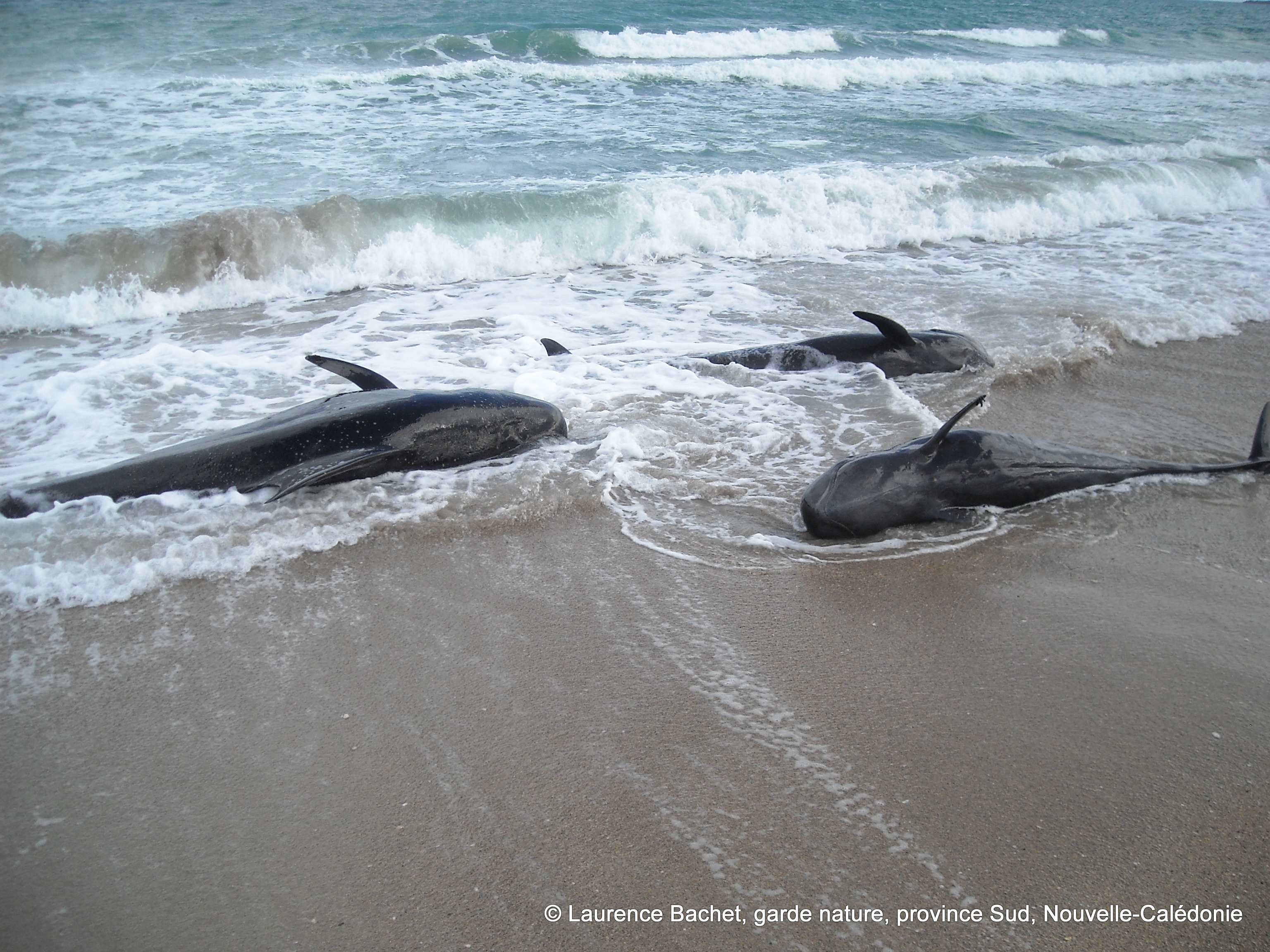
© Laurence Bachet
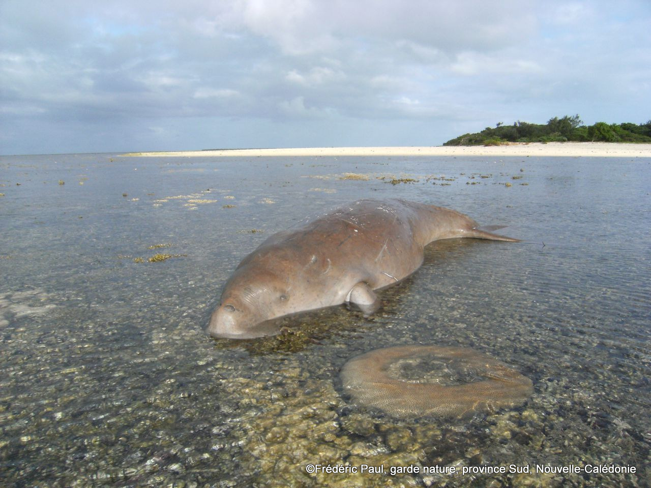
© Frédéric Paul
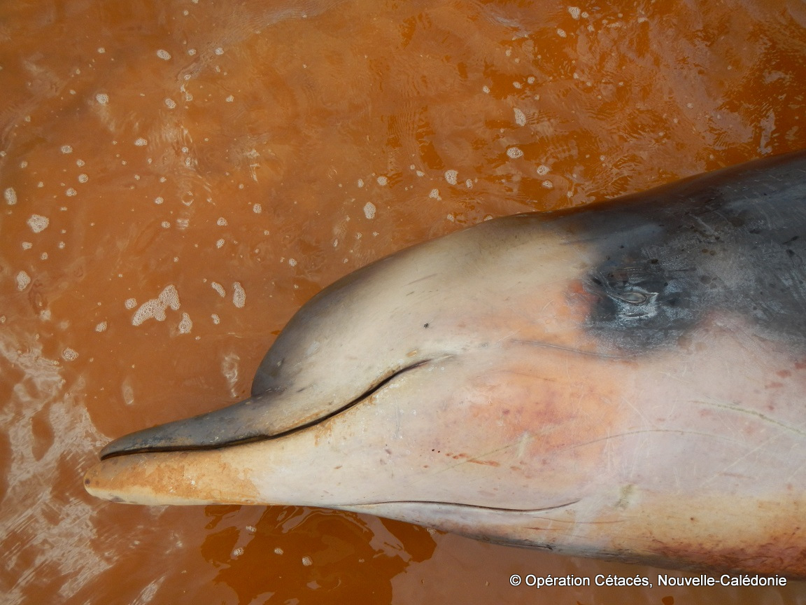
© Opération Cétacés

© Frédéric Gazzarin